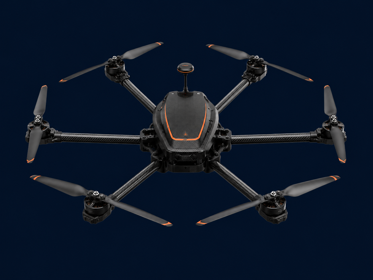
COMPREHENSIVE DRONE & AI INTELLIGENCE

From the field tothedecision.insight.alert.action.forecast.

We design and fly the drones, capture survey-grade aerial data, and build the AI that turns it — and the data already in your systems — into production-grade decisions.

One partner, from sky to system.

Distance Flown1,247 kmAcross mapping, inspection & surveillance missions
Industries Served14+From agriculture & mining to defence & smart city
AI Languages22+AI systems across 6 capability categories
DGCA StatusApprovedDrone & Sensor certified — real-world deployments
DGCA APPROVED · DRONE & SENSOR1,247 KM FLOWN14+ INDUSTRIES22+ LANGUAGES6 AI CAPABILITY CATEGORIESFIELD-READY UAVsPRODUCTION-GRADE AIONE PARTNER — END TO END

Built from the field.
Built to last.

Pomelo Pathing Pvt Ltd is a sister concern of SenseImage Technologies Pvt Ltd — a DGCA Approved, Drone & Sensor certified operator with a proven track record across industries, geographies, and AI domains.


We combine the agility of a specialized technology brand with the experience, scale, and real-world deployments of SenseImage Technologies. From crop fields to smart-city command centres, our systems are already at work.

★ ★ ★CERTIFIEDDGCA · APPROVED · DRONE & SENSORPOMELO PATHING · PVT LTD
CERTIFIED OPERATOR
DGCA Approved · Drone & Sensor
Drone in field operation
Operations team
Distance Flown1,247 kmMapping, inspection, and surveillance missions in real field deployments
Industries Served14+Agriculture, mining, defence, utilities, smart city, and more
AI Languages22+Multilingual AI systems with 6 capability categories. DGCA Approved.
Vision

Production-grade intelligence for every domain — from the field to the front office. We exist to make aerial data and AI accessible, actionable, and built to last across every industry we serve.

Mission

Capture the physical world, understand it with AI, and act on it on time — built to last. Pomelo Pathing does both halves, designed to work together from day one.

Purpose-built for every
mission.

Six UAV platforms, engineered for demanding field conditions. Each one purpose-built — whether it's mapping a mining corridor, stringing a power line, or spraying 1.5 acres in 45 minutes.

01 · HEXAROTOR
Falcon A6
The workhorse.
Falcon A6

Versatile hexarotor built for demanding field operations. Handles a wide range of sensor payloads and performs reliably across altitudes and environments.

MTOW18 kgPayload3–6 kgEndurance45 ± 5 minRange5 kmAlt. Ceiling3,000 m
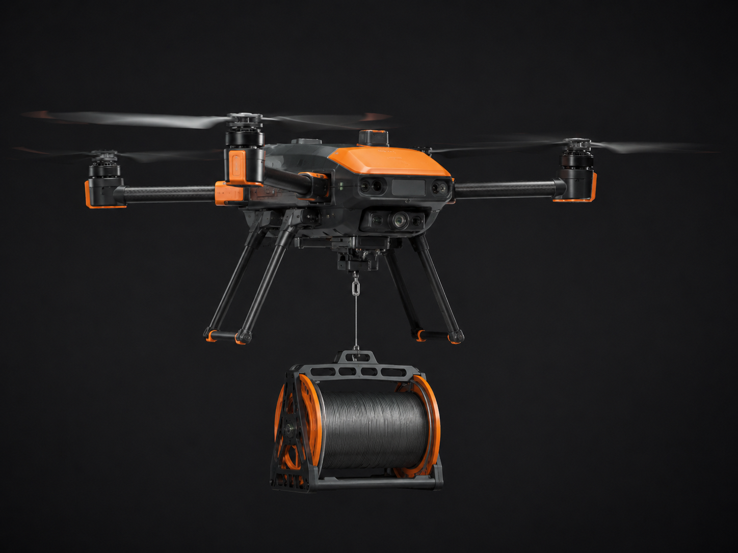
02 · STRINGING
F6 Stringing
Precision over the wire.
F6 Stringing

Purpose-built for utility corridor work. Precise, reliable, and field-ready — the only tool that makes aerial power line stringing safe and efficient.

MTOW8 kgPayload2 kgApplicationPower Line
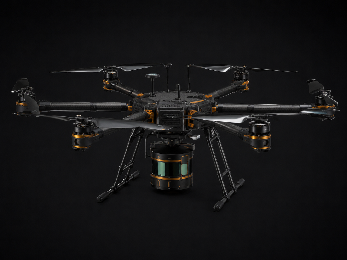
03 · HEAVY-LIFT
A6 Plus
Heavy data, zero compromise.
A6 Plus

Engineered for heavy sensor packages and complex data capture missions. The go-to platform when the job demands maximum payload flexibility and LiDAR-grade precision.

Max Payload7 kgModules200+LiDARCapable
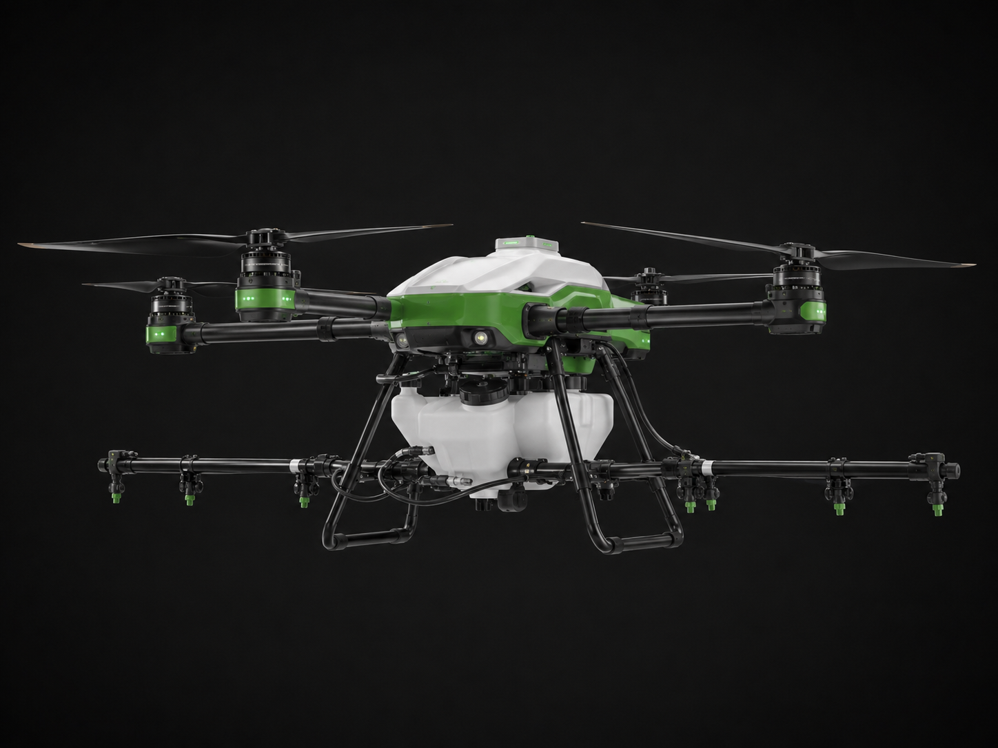
04 · AGRICULTURAL
Swift F4
From seed to harvest.
Swift F4

Optimised for crop coverage and efficiency. Sprays with pinpoint accuracy, reducing chemical use and maximising yield — precision agriculture at scale.

MTOW18 kgTank10 LCoverage1.5 ac / 45 minApplicationAgri Spraying
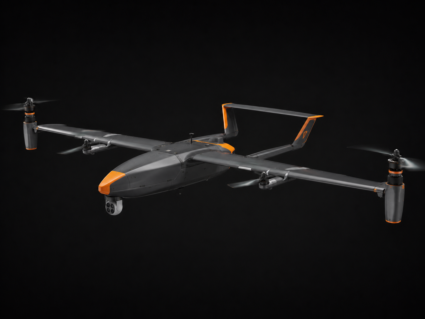
05 · VTOL FIXED-WING
SkyHunter VTOL
Long range. Vertical precision.
SkyHunter VTOL

Combines the endurance of a fixed-wing aircraft with the vertical take-off and landing capability of a multirotor. Ideal for long corridor surveys and remote area operations.

Wingspan2.4 mEndurance96 minElevation4,000 mTypeHybrid VTOL
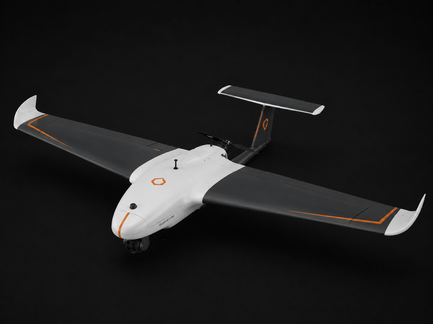
06 · MAPPING
Map X4
Survey-grade in a compact form.
Map X4

High-resolution aerial surveys in a portable, compact platform. Delivers reliable mapping data wherever you need it, without the overhead of a larger system.

MTOW4 kgEndurance35 ± 5 minAltitude800 mFormCompact Fixed-Wing

The right sensor for
every mission.

Hawk X 5-Lens Oblique
24.3MP · 5 cameras
Photogrammetry
Full 3D capture and oblique photogrammetry for the most accurate as-built models.
Thermos Thermal
640×512 · –20 to 150°C
Thermal Inspection
Fault detection, thermal inspection, and fire surveillance with radiometric accuracy.
Albatroz Optical Zoom
40× zoom · 4K video
Surveillance
Long-range surveillance, perimeter inspection, and security patrols at safe stand-off distance.
IDM X1 Intelligent Dropper
6 kg payload release
Precision Delivery
Precision delivery, SAR operations, and utility drops with intelligent release control.
Ion P5 Multispectral
5-channel sensor
Agriculture
Crop health monitoring, NDVI analysis, and precision agri-analytics at parcel level.
Hawk X1 Mapping
24.3MP · PPK-ready
High-Precision Survey
High-precision surveys and GCP-free mapping with post-processed kinematic accuracy.
LiDAR Sensors
High-density point cloud
3D Terrain Modelling
Terrain modelling, asset inspection, and 3D city modelling with centimetre precision.

Eyes in the sky,
engineered.

Survey-grade aerial data — 10× faster than traditional ground methods. One partner for the full spectrum.

Two capabilities.
One system.

Most teams buy aerial data from one vendor and AI from another — then spend months trying to connect them. Pomelo Pathing does both, designed to work together from day one.

Capture
Aerial · LiDAR · Thermal · Multispectral

Survey-grade aerial, LiDAR, thermal, and multispectral data from drone platforms we build and fly ourselves.

Understand
CV · IDP · Search · Forecasting

AI that reads imagery, documents, and operational data to surface what matters — fast and reliably.

Act
Agents · Workflows · Alerts · API

Automated workflows, alerts, and decisions wired into the systems you already run — no infrastructure overhaul.

The city,
understood.

A unified framework that captures the physical city, models it in 3D, and layers in AI-powered analytics — for smarter governance, safer infrastructure, and citizen-centric planning.

3D City Modelling

Photogrammetric + LiDAR fusion for accurate, georeferenced urban models — the authoritative digital replica of your city.

Live Data Integration

IoT sensors, traffic feeds, and utility data integrated in real time — the city's pulse, always current.

Simulation Engine

Traffic, flood, and infrastructure scenario modelling — test decisions before you make them.

Change Detection

Periodic drone overflights for continuous urban monitoring — spot what's changed, instantly.

Virtual E-Governance

Citizen portal, permits, and asset management — planning made transparent and accessible.

AI Analytics Layer

Anomaly detection, forecasting, and spatial intelligence — from data to governance insight, automated.

Planning that
works for people.

AI-powered ecosystem designed to modernize urban and rural planning workflows. Visual policy guidance transforms complex regulations into intuitive, citizen-friendly experiences.

Visual policy guidance — complex regulations made citizen-friendly
Conversational AI assistant — 24/7 support, 22+ languages
Dynamic content management — real-time updates with full governance and auditability
Seamless transparent journey — reduces administrative burden on authorities
Better Citizen Experience

Intuitive, accessible, multilingual planning interactions — no jargon, no queues.

Faster & More Accurate Submissions

AI guidance reduces errors before they become rejections.

Reduced Operational Workload

Automation handles the volume so your team handles the exceptions.

Greater Transparency & Accessibility

Every decision logged, every regulation version-controlled.

Governance built
for what's next.

Building the next generation of planning intelligence. Advanced AI-driven systems that automate compliance, assess feasibility, and predict outcomes — before decisions are made.

Advanced scrutiny engine — automates compliance checks and adapts to evolving regulations
AI-driven site assessment — feasibility analysis helps applicants make informed decisions early
GIS-based constraint identification — environmental, zoning, and planning limitation insights
Predictive analytics — assess application success probability before submission
Future capabilities — development visualization, automated document review, Digital Twin + BIM integration
Faster Approvals

AI-assisted routing and pre-checks cut decision cycles from weeks to days.

Scalable Digital Infrastructure

Cloud-native, API-first — grows with your organisation's data and demand.

Data-Driven Governance

Every decision anchored in data — reproducible, auditable, defensible.

Future-Proof Planning Ecosystem

Built to evolve — Digital Twin, BIM, and predictive modelling ready to activate.

Built for
your domain.

Energy & Utilities
Aerial Use Cases

Thermal + LiDAR inspection of lines, turbines, and solar fields

AI Use Cases

AI anomaly detection — flags faults before failure

One partner,
end to end.

Discover. Design.
Build.

A rigorous, repeatable delivery methodology — from the first use-case workshop to production deployment. No guesswork, no stalled pilots.

01 · Discover
Discover
Use-case mappingData & feasibility analysisSuccess metrics definition
Output

Scoped brief, data audit, defined success KPIs

02 · Design
Design
Architecture designModel & tooling selectionEvaluation plan
Output

Solution architecture, tech stack, evaluation framework

03 · Build
Build
Pipelines & agentsSystem integrationEvaluation harness
Output

Production deployment, integrated system, tested & measured

Ready When You Are

Let's map your
first thing.

Get in Touch

Tell us what you're
trying to move.

PARENT COMPANYSenseImage Technologies Pvt Ltd